About Us
Disasters are defined as prominent global issues which simultaneously pose a threat to multiple countries or regions around the globe. In these public emergencies, the disaster management communities have played a vital role in saving the economy and helping people to respond and recover from the disasters. Disaster management contains mitigation, preparedness, response, and recovery phases, and each phase is gradually empowered by growing geospatial big data awareness and surging computing capabilities to produce spatial vulnerability and situational picture for supporting timely decisions.
The National Science Foundation (NSF) recently announced several awards through the Advanced Cyberinfrastructure (CI) Coordination Ecosystem: Services & Support (ACCESS) program to ensure the broad availability and innovative use of the CI ecosystem that can drive transformative discoveries in all areas of research and education. Despite the growing availability of advanced CI resources, there are still significant barriers that limit broad and equitable access to the ecosystem, especially for individuals and institutions that are resource-constrained and communities that have been traditionally underrepresented. Many researchers are not aware of the available CI resources or may not understand what these resources are capable of in their fields of expertise.
This project aims to establish an International CyberTraining for Disaster Management (CTDM) network in which disaster management research communities (undergraduate/graduate students, scientists, and faculty members) can broaden their computational and cyberinfrastructure skills by participating in our CTDM training program. This project targets CI contributors and CI users with a research focus on applying CI and geospatial analytics in disaster management across Geoscience, Public Health, Engineering, Transportation, Social, Behavioral, and Economic Sciences. Through our training program, the CI users and contributors can gain CI and geospatial analytic skills to build new CI capabilities for observing, monitoring, and managing disaster events. This project also provides them with a level of core literacy so they can develop new computational skills in analyzing extensive disaster data to produce scientific outcomes.
Link to National Science Foundation Abstract
Meet the Team

Principal Investigator
Dr. Zhe Zhang
Department of Geography, Texas A&M University
Director of Cyberinfrastructure and Spatial Decision Intelligence Research Group


Co-Principal Investigator
Dr. Honggao Liu

Co-Principal Investigator
Dr. Shaowen Wang
Professor of Geography & Geographic Information Science
Associate Dean for Life and Physical Sciences, College of Liberal Arts and Sciences (LAS)
University of Illinois Urbana-Champaign
Advisory Board Members


Shelley Knuth
Assistant Vice Chancellor and Director of Research Computing, University of Colorado Boulder

Lori Peek
Professor and Director of the Natural Hazards Center, Institute of Behavioral Science, University of Colorado Boulder

Tim Cockerill
Program Director, Texas Advanced Computing Center; Deputy Project Director, DesignSafe


Samantha Arundel
Research Geographer & Interim Director, Center of Excellence for Geospatial Information Science, U.S. Geological Survey


Jorge Brenner
Executive Director, Gulf of Mexico Coastal Ocean Observing System (GCOOS)

Tao Cheng
Professor and Director of Spacetime Lab for Big Data Analytics, Department of Civil, Environment and Geomatics, University College London


Aron Larsson
Professor and Director of the Risk and Crisis Research Centre of Mid Sweden University


Lingli Zhu
Research Manager, Remote Sensing and Photogrammetry, National Land Survey of Finland

Henrikki Tenkanen
Assistant Professor, Department of Built Environment, Aalto University
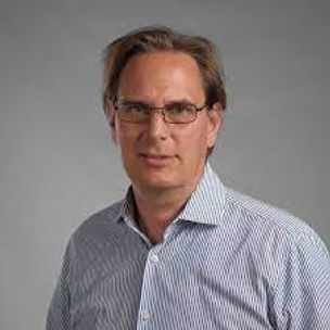
Jukka Krisp
Professor of Applied Geoinformatics, Augsburg University, Germany

Changjie Cai
Assistant Professor, Hudson College of Public Health, The University of Oklahoma Health Sciences Center

National Science Foundation
This material is based upon work supported by the National Science Foundation under Grant No. 2321069. Any opinions, findings, and conclusions or recommendations expressed in this material are those of the author(s) and do not necessarily reflect the views of the National Science Foundation.
